
Tableau ist so konzipiert, dass geografische Daten optimal genutzt werden können, damit Sie nicht nur das „Wo“, sondern auch das „Warum“ kennen und verstehen. Mit sofortiger Geokodierung verwandelt Tableau automatisch bereits vorhandene Standortdaten und -informationen in umfassende, interaktive Karten mit 16 Zoomebenen. Sie können auch eigene Daten auf Karten visualisieren, was für Ihr Unternehmen wichtig ist. Bevölkerungs-, Einkommens- und andere demografische Standarddatenbestände sind integriert und basieren auf öffentlichen Volkszählungen. Indem Sie in Tableau Geodaten visualisieren, können Sie die Welt anhand von Daten erkunden und Ihre Erkenntnisse mit nur wenigen Mausklicks bereitstellen. Sie haben auch die Möglichkeit, geografische Daten von R oder GIS (oder beliebige andere verfügbare Geodaten-Dateien oder benutzerdefinierte Geodaten) zu importieren. Diese Daten können dann mithilfe von Tableau Cloud, Tableau Public und Tableau Server einfacher zugänglich und interaktiv anwendbar gemacht werden. Darüber hinaus lassen sie sich mit anderen teilen.
Lösungen
Karten
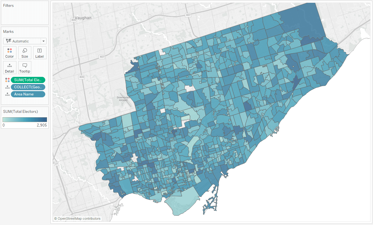
Kartendaten nativ in Tableau integrieren
Ihre Geodaten können Sie auf schnelle Weise in Tableau anzeigen. Mithilfe der darin enthaltenen Regionsnamen, Flughafencodes und Bevölkerungsdaten werden Ihre Kartendaten noch aussagekräftiger.
Erste-Schritte-Video ansehenTableau revolutioniert die Datenanalyse und macht die geografische Analyse wirklich jedermann zugänglich.
Karten als Botschafter einer Story
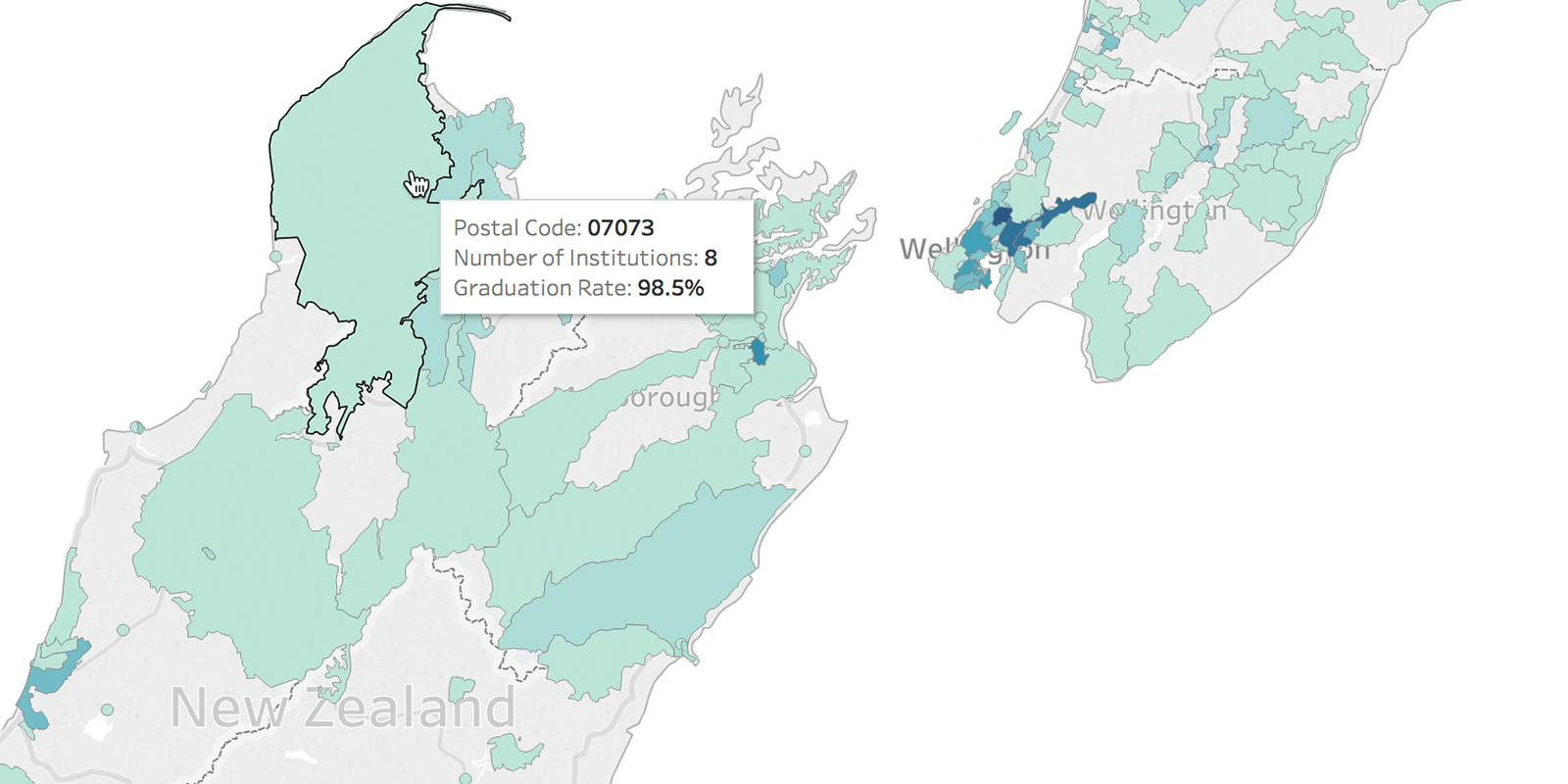
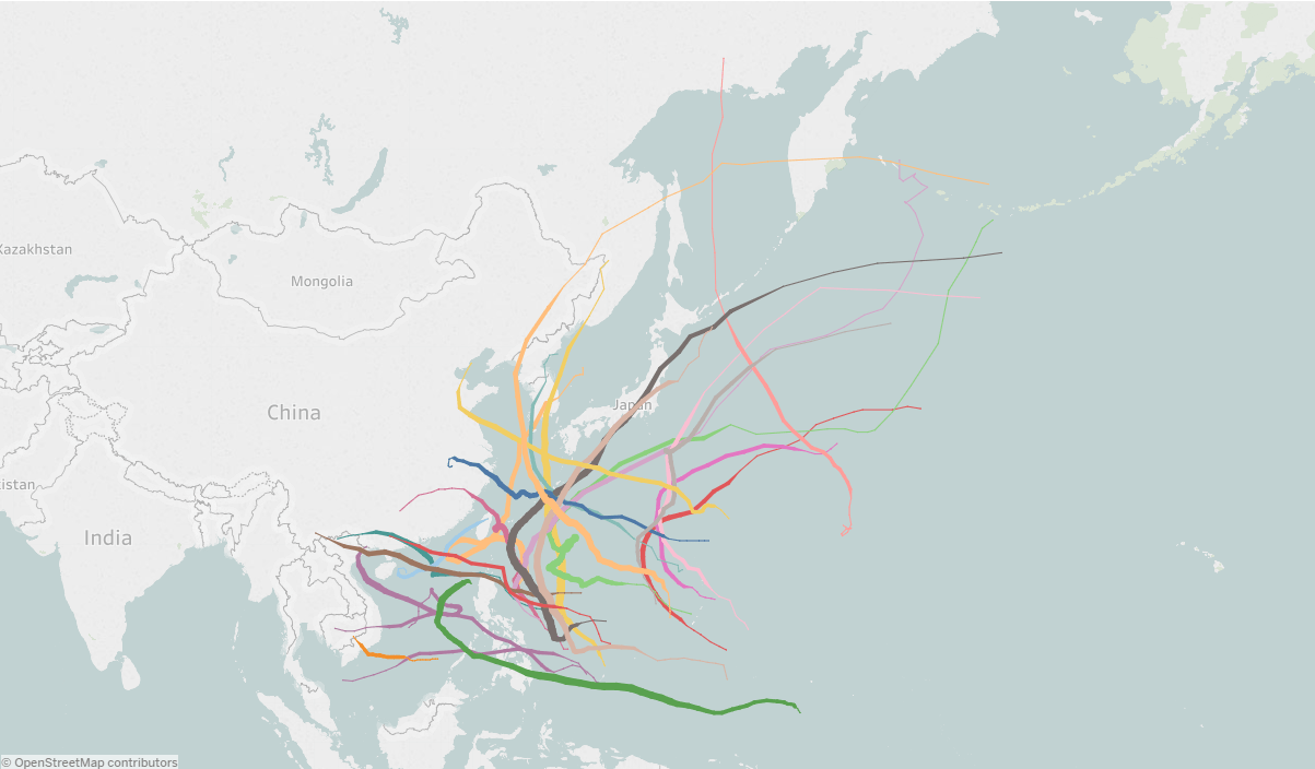
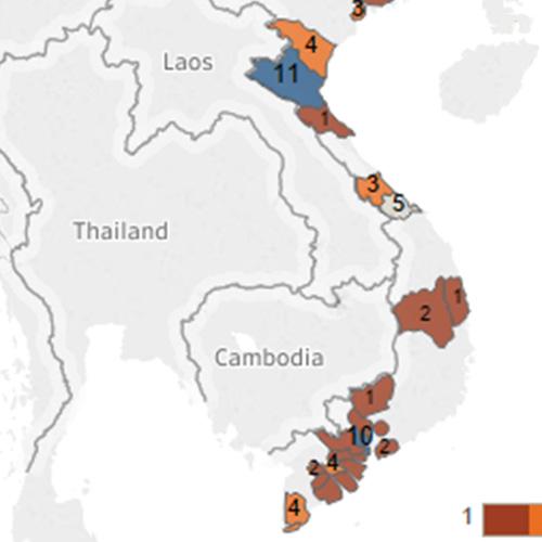
Von Symbolkarten über Choroplethkarten (oder gefüllte Karten) bis hin zu Punktverteilungskarten können Sie Ihre geografischen Daten mit Tableau auf einfache Weise mit Leben füllen. Dabei ist die Kartenerstellung anhand der Daten gar nicht der schwierigste Teil der Aufgabe. Schwieriger ist die Auswahl des passenden Kartentyps. Tableau unterstützt:
- Choroplethkarten
- Karten mit proportionalen Symbolen
- Punktverteilungskarten
- Strömungskarten
- Netzkarten (Ursprung-Ziel-Karten)
- Heatmaps
- und vieles mehr
Nutzung von Kartendaten durch Tableau-Kunden


Geodaten-Analysen mit Leichtigkeit
Der Tableau-Konnektor für Geodaten-Dateien ermöglicht eine einfache Verbindung mit Esri Shapefiles, KML, MapInfo-Tabellen, GeoJSON-Dateien sowie mit anderen Arten von Geodaten und deren Verknüpfung.
Weitere Informationen zu Geodaten-Dateien