More spatial data power in Tableau: Connect to Esri and Oracle


The upcoming Tableau 2020.2 release comes jam-packed with many great features, bringing significant updates to enhance your geospatial analysis. We’re expanding Tableau’s spatial database connections to make solving location-based questions easier than ever.
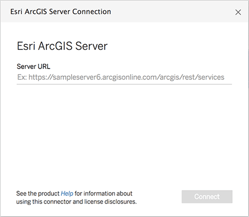
Connect directly to your Esri ArcGIS Server/Online feature data
Spend less time sourcing data and more time in analysis. In Tableau 2020.2, you can connect Tableau directly to your location data in Esri by simply entering in an ArcGIS Server URL or GeoService API URL. Say goodbye to the days of having to manually track when your data changes, download the new data from Esri ArcGIS, and then upload into Tableau—with this feature, not only can you connect directly to your Esri ArcGIS map services and feature services, you can also schedule automated refreshes of this data, to ensure your visualization is always up to date.
Accessing your Esri data in Tableau is simple. As long as your data does not require authentication to access and is made available as a feature service or a map service, Tableau can connect to it. Simply input a URL that points to your ArcGIS Server, or a GeoService API URL that points to a specific data layer, and Tableau will handle the rest.
Use Tableau and Esri together to elevate your spatial analysis
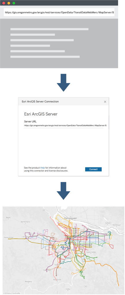
Let’s say you work in city planning in Portland, Oregon, and you want to analyze the various public transit lines of the city. Simply navigate to the desired layer in the browser, copy the URL, and paste it into the Tableau Esri Connector.
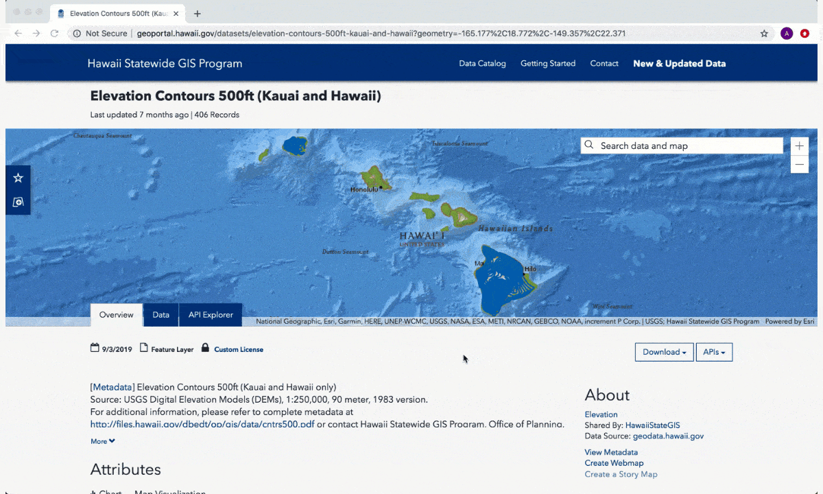
You can also use this capability to connect to your data via GeoService API. If you were interested in studying the topography of the big Island of Hawaii, for example, you could navigate to Hawaii’s Open Data Portal, find the desired data set, copy the GeoService API, and paste it into Tableau to connect.
In addition to accepting URLs that point to a specific data layer, this connector accepts URLs that point to your ArcGIS Server’s root, folders, groups, or servers, so you have complete control over what tables the connector should retrieve.
This capability is also designed to work well with the rest of Tableau, meaning that you can utilize all of the great interactivity, filtering, spatial joining, and spatial calculations in Tableau with your Esri data. In addition, this connector is compatible with Tableau’s automated extract refresh feature, so you can tell your data source how often to refresh itself. The days of manually updating spatial data are over.
Connect directly to your spatial data in Oracle
The 2020.2 release will also include native support for spatial data from Oracle. Like working with Esri data, customers will no longer have to export spatial data out of their database just to be able to visualize it in Tableau. Support for Oracle spatial data is similar to how Tableau supports spatial data from SQL Server, PostgreSQL, and Greenplum. You can use a live or extract connection or leverage custom SQL to execute a broad range of spatial capabilities supported by the database.
We’d love your feedback
Is there a spatial data source you want Tableau to support? We would love to hear from you. Submit your request on the Tableau Ideas Forum today. Every idea is an important data point for making decisions about what to build next in Tableau.
Until then, join the pre-release program to try out these new features, or visit our Coming Soon page to learn more about our other upcoming features in the 2020.2 release. Go forth and make beautiful maps!
Histórias relacionadas
Keep Payment and Cardholder Data Secure with PCI-DSS Compliance for Tableau Cloud
 10 Julho, 2025

Dynamic Color Ranges in Tableau: Clearer Visual Analysis
 21 Junho, 2025